How to Record Your Urban Adventures (Beyond Hiking)
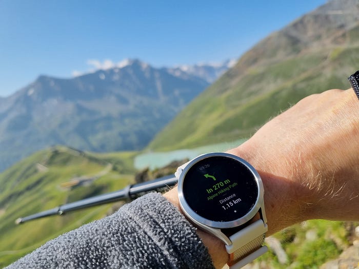
It is relatively easy to track a hiking activity with a smartphone or smartwatch – simply tap/press a button, go for a hike, and tap/press a button when you finish.
All the data is collected, the track is recorded and ready for post-processing. Whether it is about personal bests or about creating spectacular 3D videos using MapDirector – all is possible.
But what about city tourism when you switch between walking and public transport? Or travel in general, which may also include flights? It would be interesting to see them on the map too, wouldn’t it?
Of course, you can activate a walking/hiking mode as well, but in this case you can destroy your statistic. This can also consume so needed battery of your device for very accurate GPS and elevated body metrics tracking.
Alternatively, you could try relying on Google Maps Timeline or 3rd party passive GPS trackers.
During my recent trip to London, I tried this approach. My trip included a flight, lots of walking, using buses, London tube, and even the Thames Uber (a boar/ferry).
Let’s start with Google Maps
Since some time, Google keeps the timeline on the device itself only with optional cloud backup. This means that you cannot open your timeline on the larger computer screen.
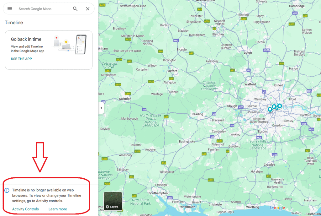
So you are forced to use your phone instead. And the visibility on a phone screen is not very great, especially in the landscape mode.
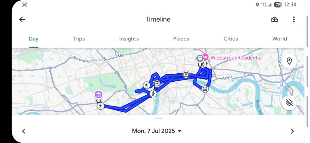
However, this information is useful for checking where exactly and when you were. It makes pretty solid guesses about places and types of movement, such as walking, public transport and even ferries. A fancy visualization, like different color for different types of movement, would be a cool feature, but, unfortunately, this feature does not exist.
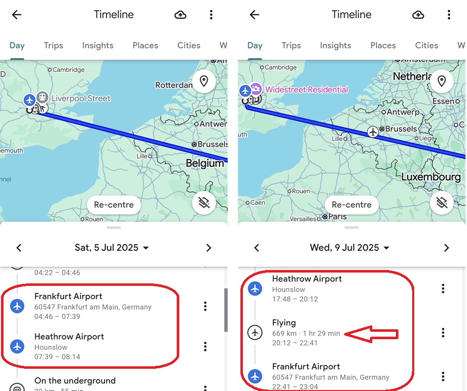
One of the flights was not recognized, but another one was. Flight paths are not detected due to lack of GPS reception inside the planes.
What is unfortunate, however, there is no way to export this track in GPX or any other format, which is a severe, if not a fatal, limitation.
An alternative approach
There is an open-source app called GPSLogger that closes this gap.
The idea is the following: The app runs in the background, periodically checks the phone’s location and stores it in a GPX file. As a result, you have a GPX file per day. This track includes your movements – more or less like the Google Maps Timeline. But: without Google being involved, usable with any GPX-compatible application, with ability to automatically upload the data to different places or even to a self-hosted Google Maps-like application. On the other hand: fixed location check intervals, no detection of places’ or types of movement.
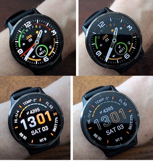
Here are two screenshots from the app:
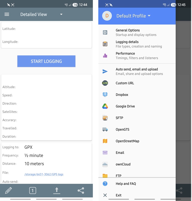
To my surprise, even with the location check set for every 30 seconds, I did not notice significant impact on the battery life.
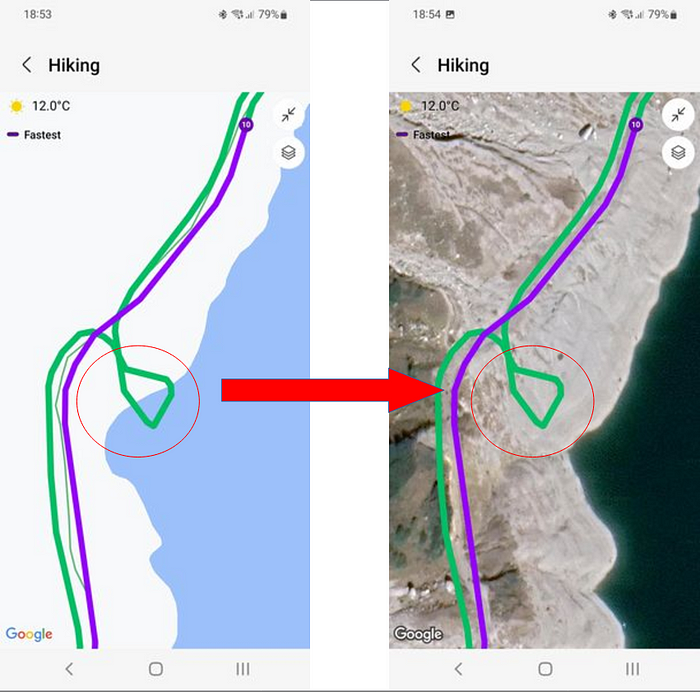
As I wrote above, you can use recorded GPX file with many different tools, from MapDirector (the video created for walking in London is not impressive) up to … Google Maps itself (or Google Earth).
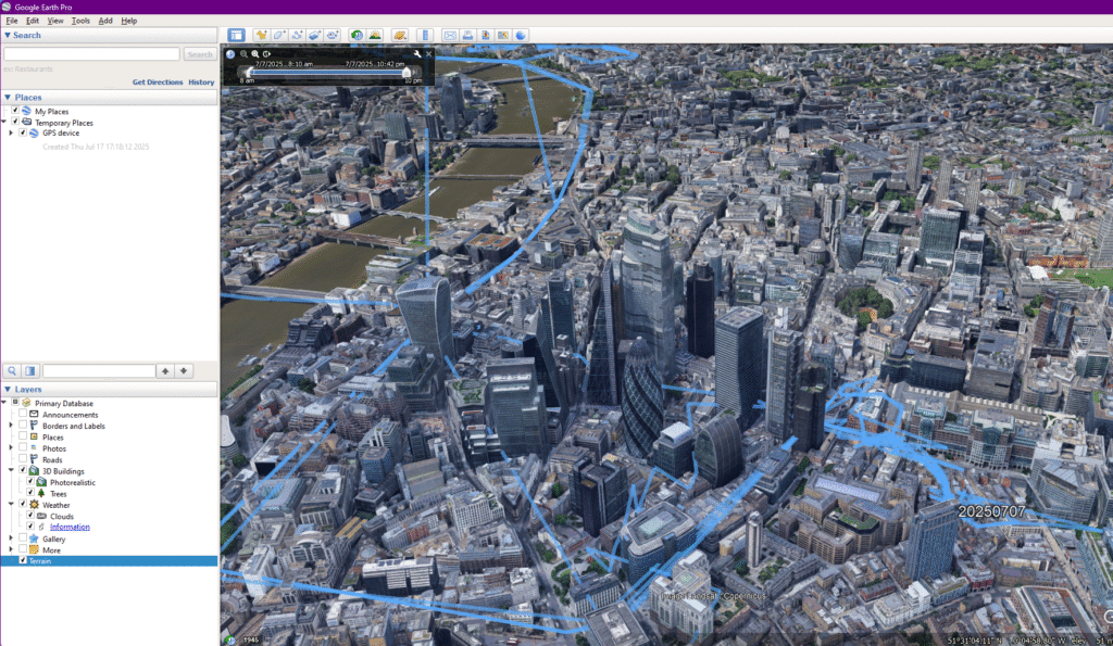
As you can see, the accuracy is not that impressive. This is understandable for buses, the underground and ferries. But most of the time I was walking.
The first reason for such inaccuracy is the 30-seconds location check -this is not enough to build an accurate route even for walking, especially in a city. Google Maps Timeline does not perform any better here. Probably, for days like this, it could make sense to increase the frequency of the GPSLogger location check. But better tests this first in safe conditions – it is no fun to have an empty smartphone in the middle of such a day!
The second reason is generally poor GPS reception I have experienced in the central of London. I noticed the problem even when I used Google Maps for active navigation – the app often placed me to the wrong location – thanks to the high buildings around me and, probably, my mid-range smartphone.
To sum-up
GPSLogger is a good alternative if you want to passively record where you were and be able to post-process your movements later, or if you want to reduce your dependency on Google.
However, if you want to analyse places you visited and how you got from one place to another, Google Maps Timeline seems to be a better option.
Have a nice day!